Geospatial data is crucial for industries like defense, transportation, agriculture, urban planning, and disaster management. Traditional GIS (Geographic Information Systems) struggle with data silos, lack of real-time insights, and security risks. Stream Analytix by Yggdrasil integrates blockchain, AI, and decentralized computing to provide real-time, secure, and interactive geospatial data visualization for better decision-making.
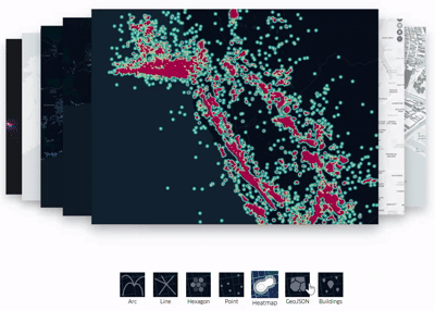
Geospatial Data Visualization Solutions
1. Blockchain-Powered Geospatial Data Integrity & Security
How It Works:
Immutable Geospatial Records: Stores geospatial datasets on a blockchain ledger, ensuring tamper-proof and auditable location data.
Decentralized Access Control: Blockchain ensures only authorized users can modify geospatial datasets, preventing data corruption.
Smart Contracts for Data Licensing: Allows secure transactions for geospatial data sharing between governments, enterprises, and researchers.
Use Case :A defense agency uses blockchain-based maps to ensure satellite intelligence data remains secure and tamper-proof.
3. 3D Interactive Geospatial Visualization & Digital Twins
How It Works:
High-Resolution 3D Terrain Mapping: Renders accurate topographical models for defense, mining, and urban planning.
Digital Twin Simulations: AI-powered digital twins of cities and landscapes help model future scenarios like disaster recovery.
VR & AR Integration: Supports augmented reality-based geospatial analytics, allowing immersive GIS experiences.
Use Cases : A transportation agency builds a digital twin of a highway network to optimize traffic management.
2. AI-Powered Real-Time Mapping & Predictive Analytics
How It Works:
AI-Enhanced Satellite & Drone Data Processing: Stream Analytix integrates real-time satellite imagery and drone feeds into interactive 3D maps.
Geospatial AI Models for Pattern Recognition: Detects land-use changes, urban expansion, deforestation, and infrastructure developments.
Predictive Geospatial Analytics: AI forecasts climate patterns, flood risks, and traffic congestion using historical data.
Use Cases : An urban planner uses AI-driven geospatial analytics to predict population growth and optimize city infrastructure.
4. Decentralized Geospatial Data Sharing for Government & Enterprises
How It Works:
Blockchain-Powered Open GIS Network: Governments, researchers, and enterprises can securely share geospatial datasets without intermediaries.
Decentralized Geospatial APIs: Developers can access verified blockchain-stored geospatial data for real-time applications.
Cross-Border Geospatial Intelligence Collaboration: Enables multi-nation collaboration on climate monitoring, defense intelligence, and infrastructure projects.
Use Cases : Multiple countries securely share satellite geospatial intelligence to monitor climate change in real time.


Empowering the next generation of decentralized economies.
copyright © 2025 Yggdrasil Ecosystems All rights reserved.